The second millennium BC cremation necropolis of Baley is located in Northwest Bulgaria at the right bank of the Timok River. The first archaeological campaign of 2010 outlined the chronology of the burial features and the nature of the burial practices which were in majority cremated human remains placed in jars of various sizes.
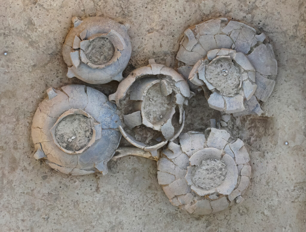
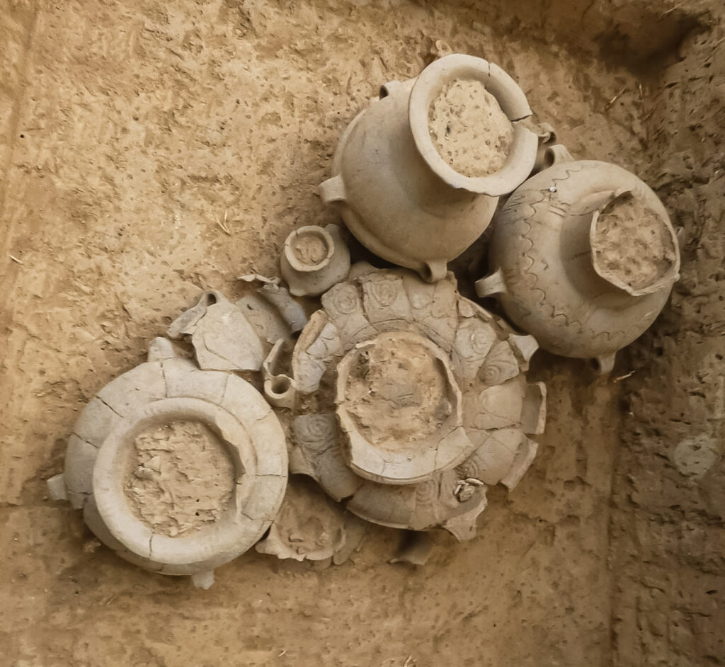
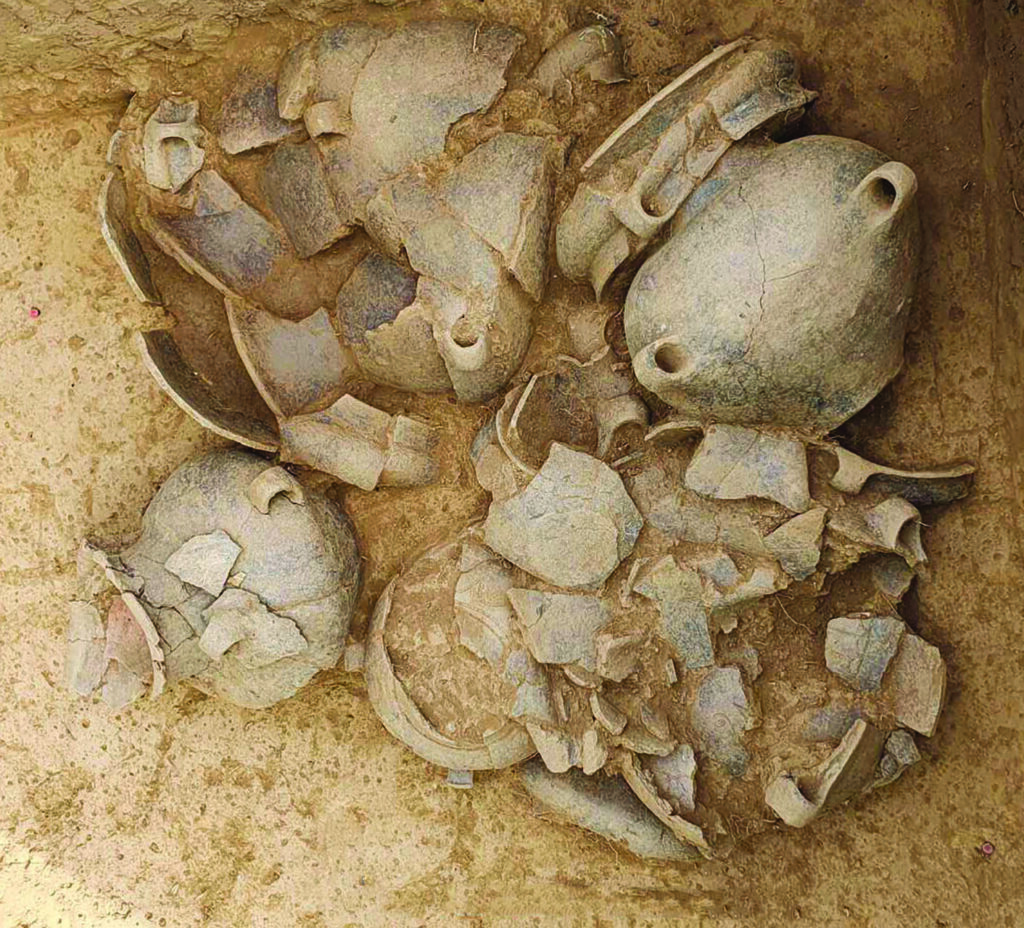
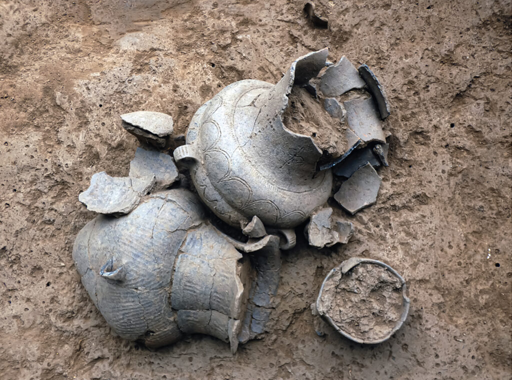
To date, a total of 164 burial features (graves and structures related to mortuary practices) have been discovered. Within these, over 450 ceramic vessels are found, a large number of zoomorphic and anthropomorphic figurines, and bronze adornments, which are representative of the burial rituals of the era.
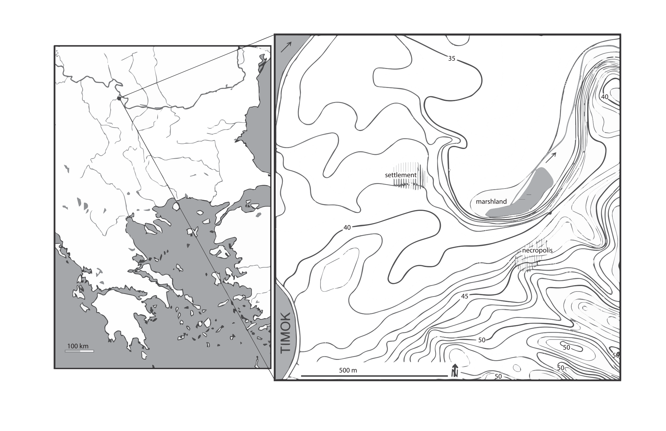
The prehistoric complex that includes an Early Bronze Age (EBA) site, Late Bronze Age (LBA) – Early Iron Age (EIA) settlement an Middle Bronze Age (MBA) – Late Bronze Age/Early Iron Age necropolis is located in the present day village of Baley, Vidin District, North-West Bulgaria, on a non-flooded sand dune at the right bank of the Timok River, approximately 2 kilometers south of its’ confluence to the Danube River. The archaeological excavations of the settlement (located in the northern edge of the village), directed by R. Katinčarov and A. Iocova lasted 18 seasons (from 1970 to 1989) remaining, generally unpublished. The necropolis, located in the north-eastern edge of the village was discovered in 2009, the archaeological investigations continuing from 2010 onwards. The main results of the LBA/EIA settlement and necropolis excavations are as follows:
The Late Bronze Age/Early Iron Age Settlement.
A total area of 4100 m2 was excavated from 1970-1989. According to the excavators, the LBA settlement had four successive building levels (IV-I) with a hiatus between levels IV and III, probably caused by a flood. Several EIA pits cutting the LBA levels have also been investigated. Although it is generally accepted that there are two main periods in the LBA settlement’s life, levels IV-III, and II-I respectively, a detailed study of the stratigraphy and the materials discovered allowed a more elaborate picture of the site to be established.
There are two main periods in the settlement’s life clearly divided by 0.50 m hiatus – level IV and levels III-I/EIA pits. However, the earliest LBA anthropogenic activities are connected to 5 pits located beneath level IV dwellings. That level is marked as level IVb. Level ІVа covers approximately 1000 m2. Three dwellings and parts of two others have been investigated in the southern part of the excavated area. They are rectangular in shape, bipartite, one of them (the so called “megaron”) with quite impressive dimensions: 14.40 x 5.60/5.80 m) being fronted by an open porch. The eleven pits of this level are grouped approximately. 30 m northwest of the dwellings (fig. 2/5).
The level ІІІ structures are located in an area of approximately 2300 m2. Six dwellings and remains of another 5 with 1.30m wide passageways in-between them have been investigated in the north-western sector, while the south-eastern sector included remains of 4 hearths/ovens only. The dwellings are irregular trapezoidal or rectangular in shape; one of them – bipartite. Four pits also belong to this level which are situated between the two residential groups. The level ІІ structures are located over a 2000 m2 area, with 15 dwellings/parts of dwellings located mainly in the western sector. They had apsidal or rectangular shape; one of the latter – bipartite with quite large dimensions: 9.80/9.85 by 4.10 m. The excavated pits of this level are located east of the build-up space.
The dwellings of level І had most likely been located in the north-eastern section of the site, and were heavily damaged during the modern construction of brickyards and soil extraction. The 14 excavated pits from this level are located south/south-west of the residential structures. According to the materials discovered, an internal division into levels Ib and Ia is proposed. Three pits date to the EIA Basarabi Culture. In all excavation seasons, the artifacts from this age appeared over the entire surface, which suggests the presence of more EIA Basarabi Culture pits or residential structures which were destroyed by later anthropogenic activity. The analysis of the uncovered materials compared with the stratigraphic sequence allowed the researchers to establish the following internal periodization of the settlement’s life: levels IVb-IVa (LBA); levels III-Ib (LBA); level Ia (LBA/EIA) and EIA/Basarabi Culture
The Middle Bronze Age – Late Bronze Age/Early Iron Age necropolis
It is located approximately 500 m south-east from the settlement with a portion of the necropolis situated under modern residential properties. The archaeological investigations were focused in the area outside those properties, with more than 1000 m2 excavated up to 2022. One hundred and sixty cremation graves and features connected to the mortuary practices have been investigated in this necropolis. Some of the graves have been destroyed by modern anthropogenic activity. Another four partly destroyed graves have been excavated about 100 m southwest of the main area within the limits of the modern village, indicating that the northeast – southwest axis of the necropolis was at least 120 m in length. Over the entire excavated area, the recorded ritual methods are cremation outside the boundaries of the necropolis and after the cremation some of the burnt bones were collected from the pyre, cleaned, and placed in vessel/s used as urn/s. Five chronological groups in the necropolis have been established thus far which chronologically cover the first half of the second millennium BC (first group), 1500 – 1200 calBC (groups two – four) and the transition to the Early Iron Age (1200 – 1050 calBC).